24 March 2024 · Yves Gerster
Across the Mediterranean and Back
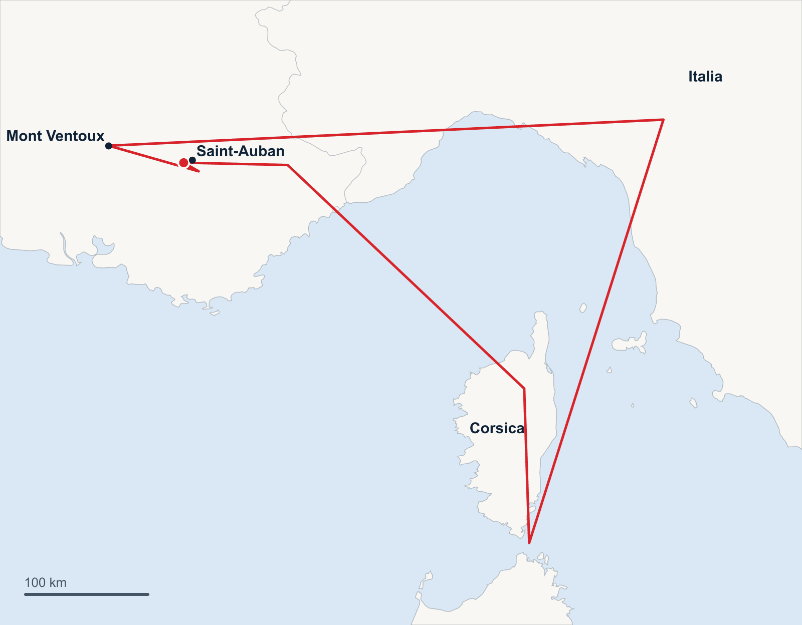
Riding the mistral from Saint-Auban across the open sea to Corsica, on to Italy — and back at the home airfield by evening: a 1,328 km triangle, engine never started.
- 1 328 km
- Distance
- 120 km/h
- Average speed
- 11 h 19 min
- Airborne
- JS1C 21 m
- Glider
In 1974 the French pilot Jean Vuillemot let the mistral carry him across the Mediterranean and became the first to land a glider on Corsica from continental Europe. Half a century later I wanted to know whether that dream could be taken further: not just flying to the island, but carrying on across the sea to Italy — and standing back at the home airfield the same evening.
On 24 March 2024 it all came together. Starting from Saint-Auban in southern France, the triangle over Corsica and the Apennines worked out — 1,328 km in a good eleven hours, engine never started, back to the point of departure.
One day of preparation for eleven hours of flying
Only the day before did it become clear that the weather would fit. A strong mistral veering west towards the south is the prerequisite: it produces the lee waves over the southern French Alps and over Corsica. The second half of the task needs thermals or convergence over the Apennines — and the whole day has to be flyable.
While my friends enjoyed a classic Alpine day, I sat over the planning. NOTAMs, flight plan, radio frequencies, minimum altitudes for every leg, documented landing options down to beaches: every question I might ask myself in flight, I wanted answered beforehand. A task file with dozens of waypoints marked the forecast wave areas, so even without phone reception I would know where the lift should be. And where Vuillemot once carried a life raft, at least a life jacket lay in my cockpit.
Riding the mistral across the sea
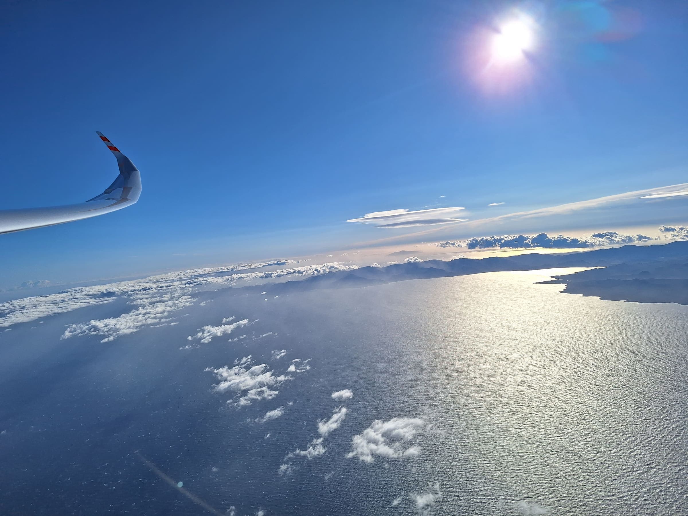
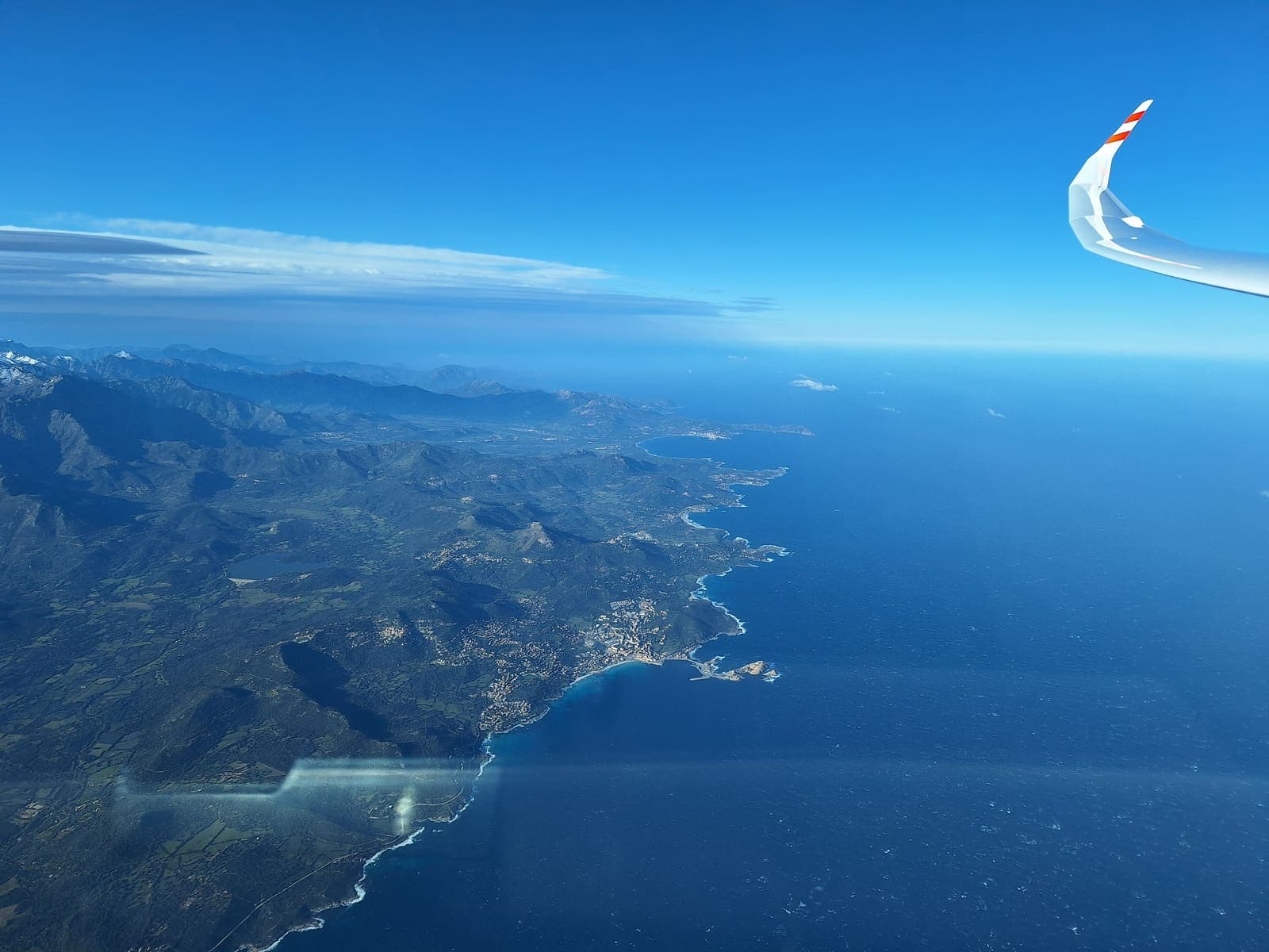
Wave flights are not for late risers. At 05:20 UTC I climb into the Lure wave abeam the airfield and barely an hour later I am at the coast. One last photo of the mainland — then there is only water ahead.
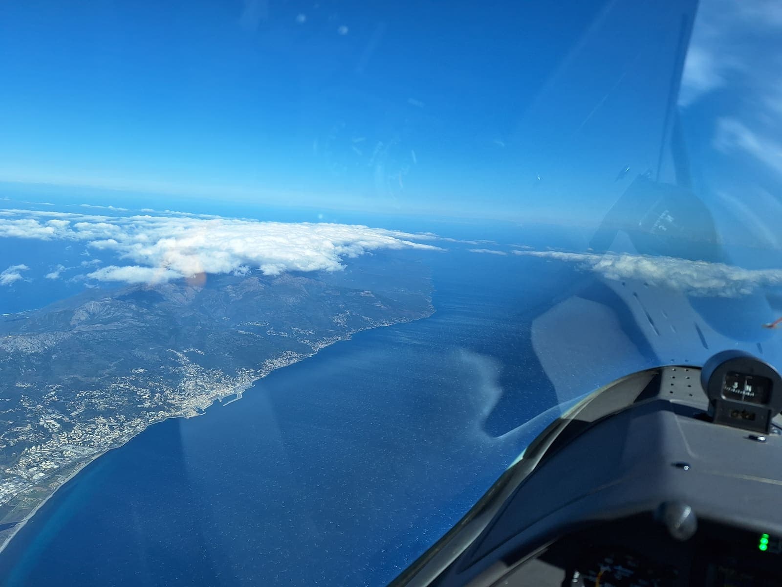
Paradoxically, the long crossing is the most relaxed part of the flight. Straight ahead, tailwind — and no phone reception. Digital detox at 5,000 metres. The only difficulty is the strong wind, which demands an unusually large drift correction. Corsica only takes shape late on the horizon; I reach the island at a comfortable 3,000 metres and slot into the local wave system abeam Corte.
Through controlled airspace
The route deliberately stays inside Marseille's airspace: a lone glider that cannot even comply with "maintain altitude" is not an everyday customer for controllers. That makes thorough preparation and strict radio discipline all the more important — I report position and timing the way IFR traffic does. One memorable exchange happens anyway, when an Italian controller asks me to hold my level:
"This is a very unusual flight for us." — "I understand. It's a very unusual flight for me, too."
Apennines, Po Valley, Genoa
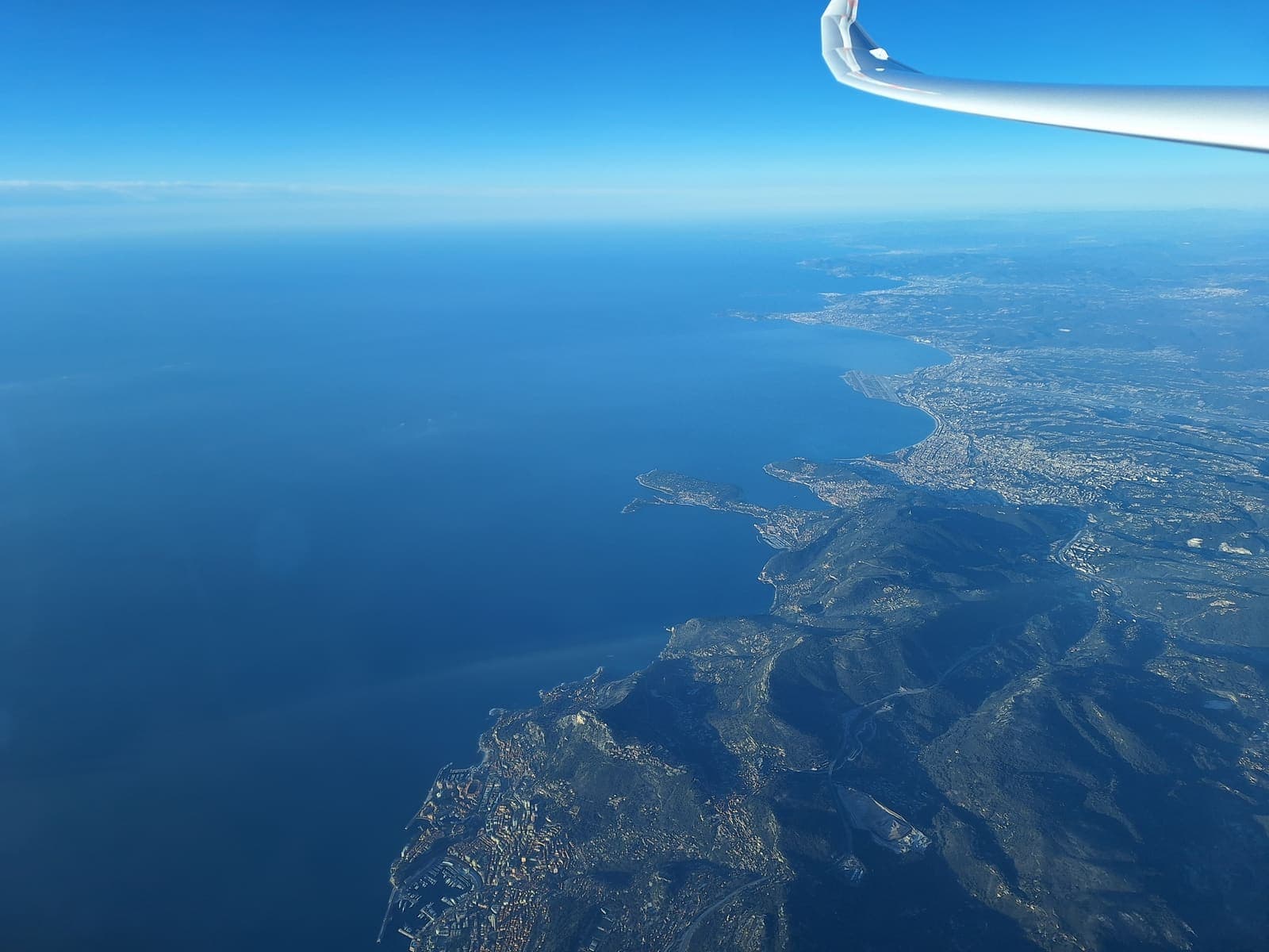
The second leg across the sea is shorter but harder — no tailwind this time. At 10:30 UTC I reach the mountains abeam Pavullo and circle for the first time since take-off. Northbound along the Apennines a pronounced convergence line paves the way: mountains, sea and a deep blue sky.
The most difficult part is still ahead. The Po Valley and the Genoa area are considered tricky and are usually avoided by local pilots. But again and again small wisps of cloud form, and I simply follow them — they also open the otherwise complicated eastern entry into the Alps.
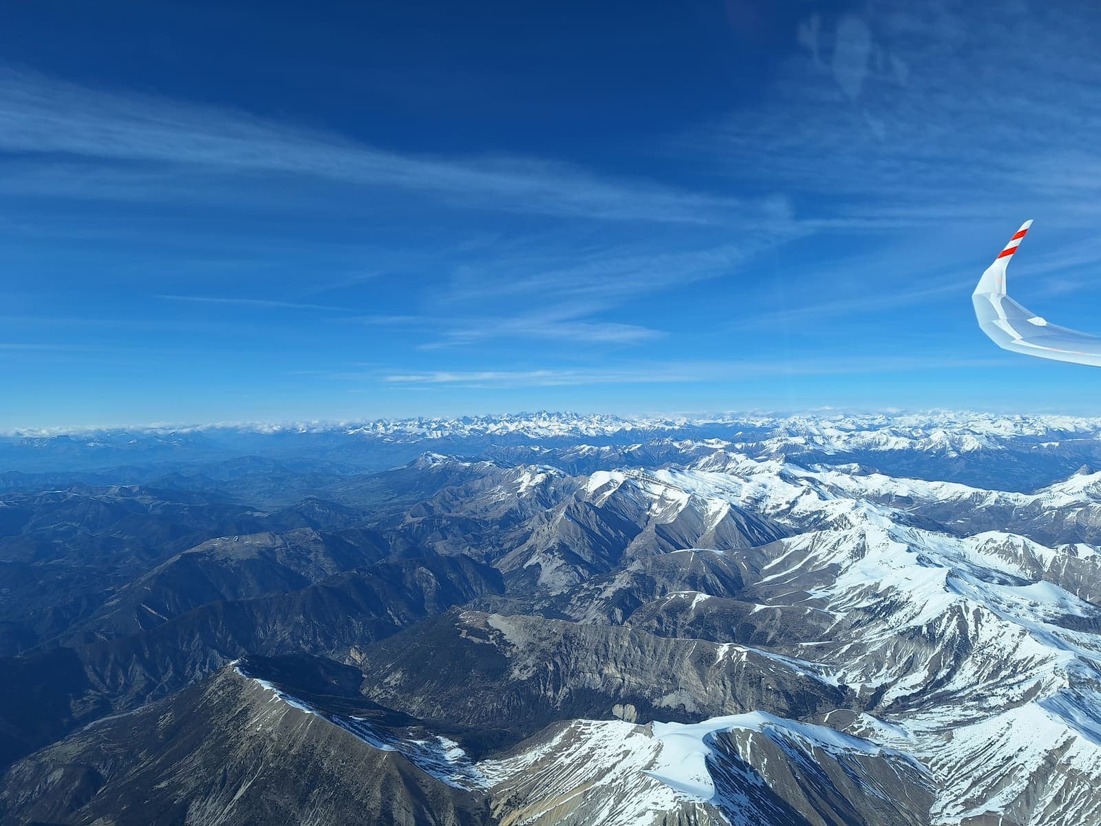
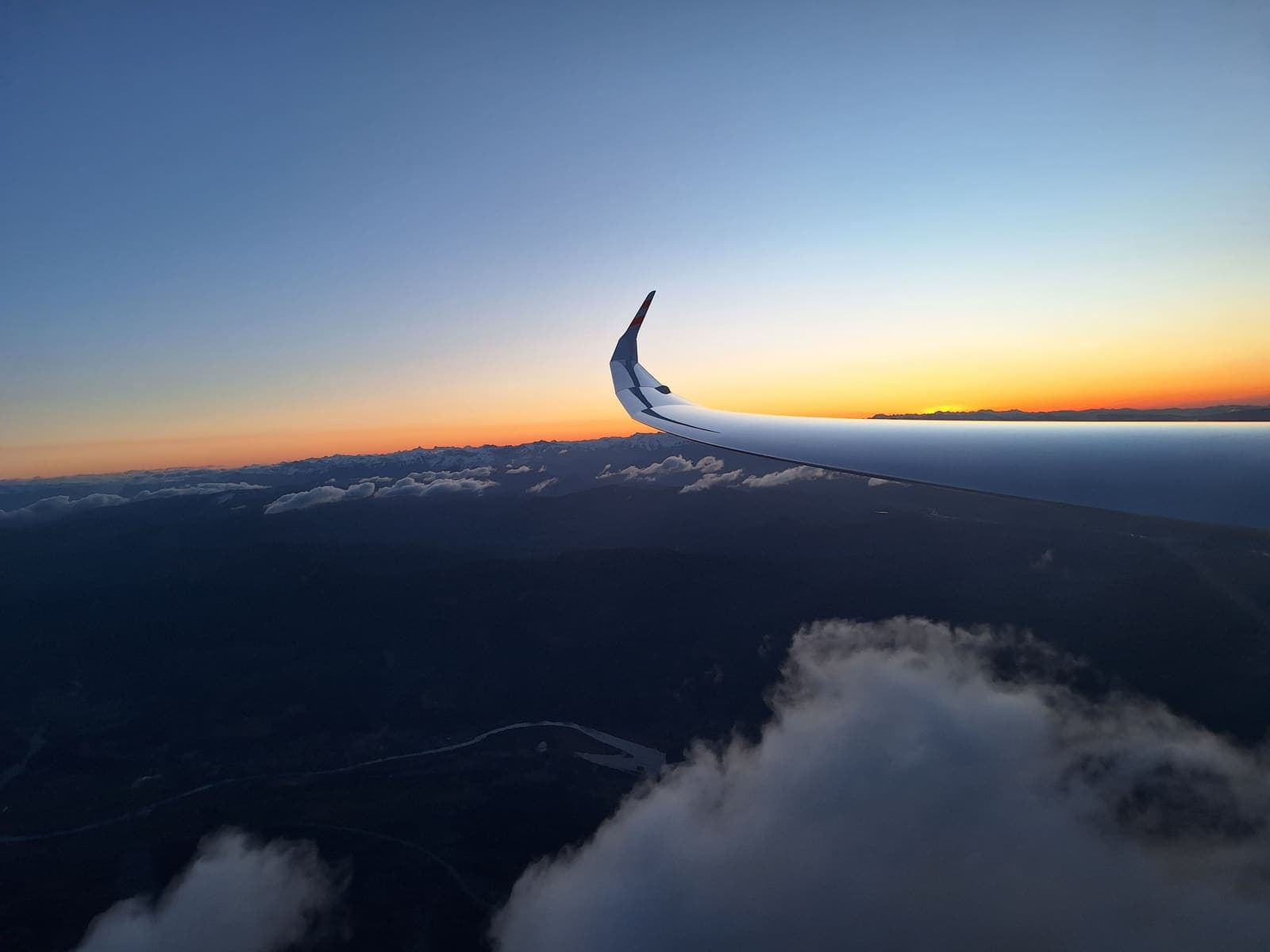
Home in ridge lift
The last turnpoint sits at Mont Ventoux — chosen because it lets me fly a large share of the final leg in ridge lift. At 16:15 I am back at the Lure, where everything began that morning, and shortly afterwards the JS1 rolls out at Saint-Auban. My friends are still airborne. It was a seriously good day: realistically another 200 km would have been possible — but this way there was still time to drive home to Bern that same evening.
The full story of this flight was told by Katharina Diehn in aerokurier 9/2024 ("Reif für die Insel"). The original article is linked below.